
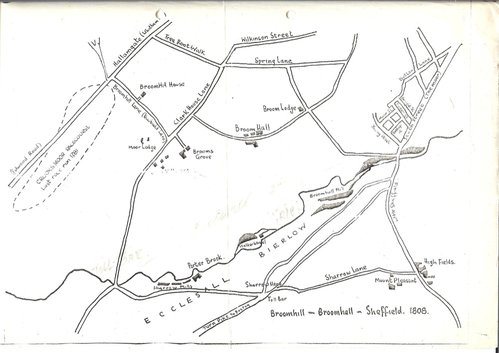
This hand drawn map of Broomhill and Broomhall shows the area in 1808.
The following description, from an unknown newspaper extract in the Broomhall Park Association’s archive, gives a great sense of the area at the time:
EXTRACT FROM NEWSPAPER CUTTING. Vol 1 – 2. P.64
“Around the hall lay a beautiful estate, richly cultivated, well-watered and well-wooded This rural park began to be effaced in 1809 when John Watson of Shirecliffe Hall bought a considerable portion of the estate. For twenty years he turned the property into agricultural lands, and then in 1829 he granted the first building lease. Building followed on an extensive scale, and now the whole district is filled with villa residences of an imposing character.
Old Broom Hall, altered and enlarged, but still retaining much of it’s ancient character, in parcelled out into residences, occupied as Dr. Gatty says, “by families of the highest local respectability”. In the days before the cutting up of the Broom Hall estate, Black Lamb‘s Lane, now Broomhall Street, was a country walk, Broomgrove was not a road but a solitary house, the cemetery did not exist and footpaths led to the remote region of Sharrow Head.
Gardens abounded, the vicinity of Hanover Street was “marked out like a chessboard” by these gardens,” and ‘there were similar gardens higher up Broomspring Lane and Wilkinson Street, and on the site of tho Baptist Church on Glossop Road and up to Northumberland Road, and opposite Mushroom Hall to Westbourne, Mr. Cadman‘s house. From Glossop Road the Water Company’s land extended into Brook Hill, and the gardens on this piece were always considered some of the best in the town.“
Writing in 1791, a local historian said: “I very well remember coming with my father through the wood called Broomhall Spring. It extended from about Wilkinson Street to Broomhall Park, It was full of very fine oak trees, with very little underwood, and the turf was soft like that of a park. I remember very well seeing the trees and the grass and the sunlight gleaming among them. Not long afterwards the wood was cut down, The Governmant was then wanting a great deal of oak-timber for ship-building, and the trrees in Broomhall Spring were sold for that purpose. The roots were dug up and the land turned into gardens”
Map used by kind permission of the Kelham Island Museum, Sheffield (MNRC 173)


No Comments
Add a comment about this page